 Login / Register
 Contact
Ancient Routes of Israel
When reading about the history of the Middle East and, in particular, the Holy Land, you’ll often hear references to the term ‘‘ancient Israel’. But what does that really mean? Well, in large part it is to do with the tribes and kingdoms that were formed by the Jewish people in the Levant in ancient times. (The Levant is an area that, today, is made up of Lebanon, Jordan, Syria, Israel and Palestine)

A camel rests between trips, Negev Desert, Israel. Photo by Cole Keister on Unsplash
Ancient Israel's main agricultural products were grapes, olives, lentils, dates and grains (usually wheat or barley). Over time, they developed a thriving trade with Egypt, Greece and Cyprus (using their ports on the Mediterranean). But how did they travel further afield? By creating different routes, some which ran by the sea and others which ran over hilly terrain.
Below we’ll be taking a look at certain ancient routes in Israel - some no longer exist, and others have been ‘modernised’ to give tourists a sense of what life was like thousands of years ago when people travelled by foot and with camels to explore new lands and trade their wares...
The Via Maris
The Via Maris was, for sure, one of the most significant ancient Israel trade routes. Both In Hebrew (‘Derech haYam’) and Latin, this means ‘ Way of the Sea’ and references to it can be found both in Isaiah (in the Hebrew Bible) and Matthew (in the Christian Bible). It dates back to the early Bronze Age and was a route linking Egypt with the northern empires of Syria, Mesopotamia and Anatolia.
‘Via Maris’ is a Roman term and the reference to the sea is, of course, the Mediterranean Sea - the stretch of coast through which the route passed. It is also known by other names - the ‘Coastal Road’ and ‘the way of the Philistines’ and in modern-day Israel, it is referred to as the ‘International Coastal Highway.’

Tel Aviv Port, Israel. Photo by Shai Pal on Unsplash
The Via Maris was one of three major trade routes that were used in ancient Israel, along with the Ridge Route and the King’s Highway. Within ancient Israel, it ran from the Galilee (in the north) to Samaria (in the south) and passed through the Jezreel Valley.Along the route, it split into two branches - one that ran along the coast from Acre down to Ashkelon and Gaza, and the other that took an inland route, through the Sea of Galilee and Jezreel Valley, the two branches reunited at Megiddo (known in contemporary times as ‘Armageddon’).
The Via Maris was a principal coastal highway for traders and the one most of them chose to travel on from Egypt and then far north. There were simple reasons for this - it was close to water, sources of food and towns. It also avoided the highlands. Megiddo was equally important as a pit stop on this route, guarding the western branch of a narrow pass on the most important trade route of the ancient Fertile Crescent.
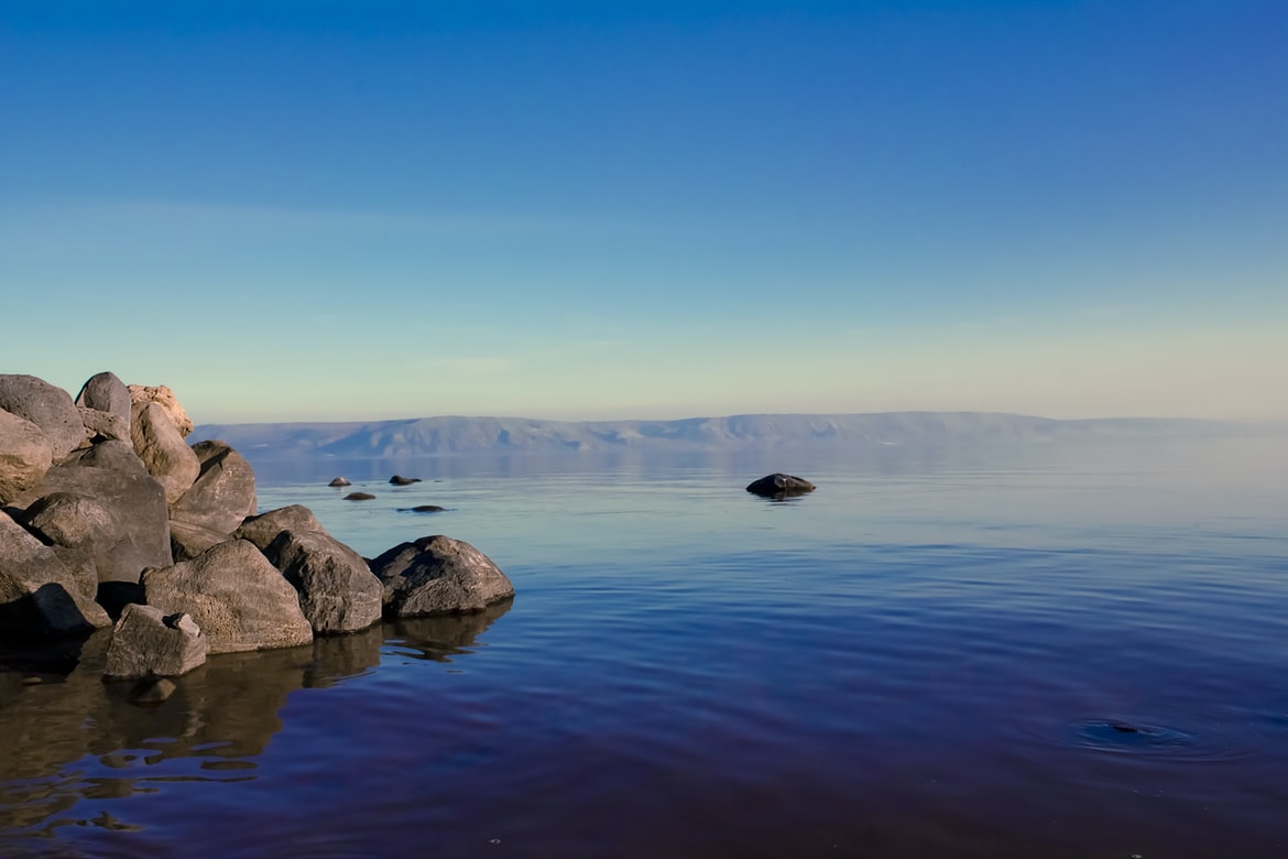
Sea of Galilee, Israel. Photo by Chris Gallimore on Unsplash
The Via Maris connected all of the major trade routes stretching from Egypt and Syria to Iraq, Turkey and modern-day Iran. As a major thoroughfare, it connected the Sinai with Damascus passing, as mentioned before, through the Jezreel Valley. Over the centuries, after the Jews were exiled from Israel, that valley was abandoned and became a marshy, swampy area.It was only revitalised after Zionist pioneers arrived in the early 20th century and set about draining the land; today, of course, it is unrecognisable - filled with orchards, greenhouses and kibbutzes/moshavim that produce all kinds of fruits and vegetables.
Crucially, branches of the Via Maris also intersected with the major trade routes of its era including the Silk Road, the Indus Valley and beyond. The Via Maris was a ‘home base’ for explorations of worlds beyond - indeed, it was really the beginning of commerce, where Jews would trade fish, grains, oil and dairy for everyday staples from the Far East (as well as luxuries like spices).

Nachsholim Beach, Nahsholim, Israel. Photo by Ben Michel on Unsplash
The King’s Highway
The Kings Highway (also referred to as the ‘Via Nova Traiana’ was an ancient thoroughfare that connected the Gulf of Aqaba and Syria through the area that we now know as Jordan. One of the world’s oldest continually used routes of communication, it is mentioned in the Hebrew Bible.
The King’s Highway was a crucial passage for ancient trade, running from north to south of this part of the Levant. The Roman Emperor Trajan (who reigned from 98-1117 CE) actually renovated the road, in his desire to improve communications and transport between Aqaba and Bostra.
Once ‘modernised’ the road was then referred to as the ‘Via Nova Traiana’ (as opposed to another road, in Italy, that had been built by the same Emperor, named ‘Via Traiana’. The King’s Highway was a crucial artery for Crusaders, journeying from Europe via Syria to Jerusalem on their military pilgrimages and for the interested visitor, there are many fortified castles to be explored on its route, even today.
Today, the King’s Highway is still promoted as a tourist attraction with more rural parts of Jordan. It links up important historical sites such as Al Karak, Al Tafilah and, most notably, Petra, as well as beautiful natural sites such as Wadi Al Mujib.

Wadi Rum, Aqaba, Jordan. Photo by Rinaldo Vadi on Unsplash
The Ridge Route
This path was of less importance for international trade than either the Via Maris or the King’s Highway but, nevertheless, travellers used this route. They would travel through the hills of Judea and Samaria, passing by the city of Jerusalem. It was called the Ridge Route (or sometimes the Hill Route) because it followed the watershed ridgeline of the surrounding mountains.
The Way of the Patriarchs
This ancient north-south route crisscrossed the land of Israel. It was given this name by biblical scholars because of its having been mentioned in biblical narratives. This, you see, was the route often travelled by Abraham, Isaac and Jacob, the three founding fathers of Judaism.
Also known as Derech ha Avot (the Hebrew term), it linked Jerusalem and Hebron and today can be found between the communities of Alon Shvut and Neve Daniel in the Gush Etzion part of Judea. Unlike the Via Maris and the King’s Highway, which were ancient roads that ran international borders and passed through the territory of many different peoples, this route was entirely within the territory of ancient Israel.
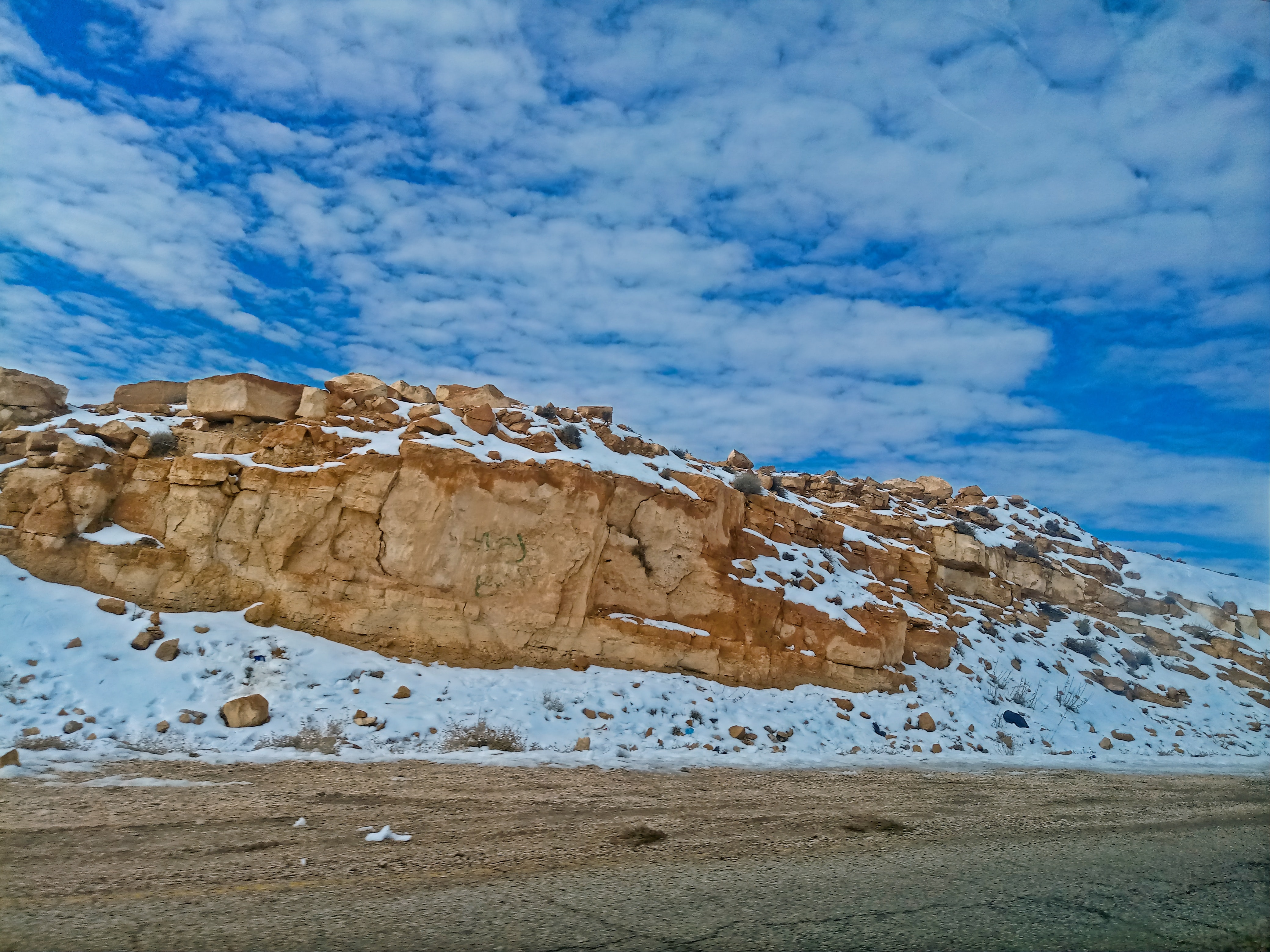
Snow in Kings Highway, Jordan. Photo by Thales Botelho de Sousa on Unsplash
The Incense Route
The Incense Route was an ancient trade network of important land and sea trading routes. It connected the Eastern world with the Mediterranean and involved ports all across Egypt and the Levant, as well as northeastern Africa, Arabia, India and the Far East. From the 3rd century BCE until 2 CE, the Nabateans were transporting incense across the desert, from Arabia to the Mediterranean and, from then on, demand for other luxury goods in the Roman world flourished.
The Incense Route was a way to trade all kinds of articles, including Arabian frankincense and myrrh. Gold, rare woods and feathers came from Africa whilst precious stones, pearls, silk and spices arrived from India and further east. The Incense Trade Route was, in the main, controlled by the Arabs, who transported goods by camel caravans and for almost 700 years, this hazardous but very profitable trade was carried on.

Mamshit, Nabatean city, part of the Incense Road, Israel. Photo credit: Jenny Ehrlich
Merchants also had other ingenious ways of trading on this route - indeed, some individuals in Southern Arabia constructed inflatable rafts made out of animal skins. From there, they could secretly float bundles of incense out on the Arabian sea, where ships were clandestinely waiting for them. The ships would then sail up the Red Sea in the dead of night and drop off the incense at ports in Egypt.Today, visitors to Israel can explore the Incense Route down in the Negev desert. This UNESCO World Heritage Site is a wonderful site, with archaeological sites and desert panoramas. The ‘Spice Route’ as it is called by locals, is perhaps best explored on a jeep trip since much of the terrain (especially in the Arava part of the desert) is barren and suitable only for experienced hikers.
Travelling north on the Spice Route, a particularly fine place to visit is Mitzpe Ramon, home to the world-famous crater. Whether you want to hike inside it, wander around its parameters and enjoy the views or abseil down its side, you’re bound to enjoy yourself. There’s also an ‘Artists Quarter’ nearby, as well as a farm selling local goats’ cheeses and many visitors choose to stay overnight in Bedouin campsites.

Mitzpe Ramon, Israel. Photo by Dmitry Shamis on Unsplash
The Gospel Trail
The Gospel Trail was established by Israel’s Ministry of Tourism in November 2011, giving Christian pilgrims (and indeed anyone else interested in this period of history) the opportunity to walk in the footsteps of Jesus. Consisting of over 60 km of paths and roads with special signposts, tourists can walk, hike or cycle as little or as much of the route as they choose.
The route itself runs through Galilee, beginning at Nazareth (where Jesus spent many of his formative years) and ending at Capernaum, on the edge of the Sea of Galilee. It follows the route Jesus was supposed to have taken (referenced in the Book of Matthew, in the Christian Bible) when he left his hometown and set off for Galilee, where he would begin his ministry.
The main part of the route begins, as stated above, in Nazareth, and visitors can walk along the Nazareth range, affording panoramic views of Mount Tabor, the Church of the Transfiguration, Kfar Kanna, and the Turan Valley.

Column in the synagogue, Capernaum, Israel. Photo by Phil Goodwin on Unsplash
The path then slopes down through the Arbel cliffs towards the sea of Galilee, until it reaches ancient Magdala (the home of Mary Magdalene). From Magdala, it continues north along the Sea of Galilee until it reaches what is known as the ‘Holy Triangle’ - the places that are the Mount of Beatitudes, Tabgha, and Capernaum.
From there, visitors can walk the length of the Sea of Galilee on the promenade (or bike around it, if they are fit!) and stop along the way to see all kinds of attractions, including national parks, churches and the baptismal site of Yardenit.
Israel National Trail (Shvil Israel)
This hiking trail traverses the length of the country, stretching approximately 1000 km from Kibbutz Dan in the far north (near the Lebanon border) all the way down to Eilat, on the Red Sea. Loved by nature enthusiasts, biblical scholars, and adventurers alike, it's the perfect way to see Israel’s natural beauty.
The Israel National Trail was the idea of Abraham Tamir and Ori Dvir, who were avid Israeli hikers. Inaugurated in 1995, it has given thousands of locals and tourists the opportunity to experience Israel’s varied landscapes up close and personal - from mountains and hills to deserts and wadis. A continuous footpath across the country, it has been lauded by nature enthusiasts, ramblers, hikers, and even National Geographic.

Mountains near Eilat, Israel. Photo by Josh Appel on Unsplash
 Certificate of Excellence
 Guaranteed Departure
 Low Prices Guaranteed
 24/7 Support


